Algorithm Final Course Project
Shortest path optimization in a dynamic rain-exposed city grid
Project Description
Developed for the Algorithms and Data Structures course (2022/2023) at the University of Bologna.
The goal was to implement a highly efficient algorithm to find the shortest path in a N x M grid-based city map.
The Challenge
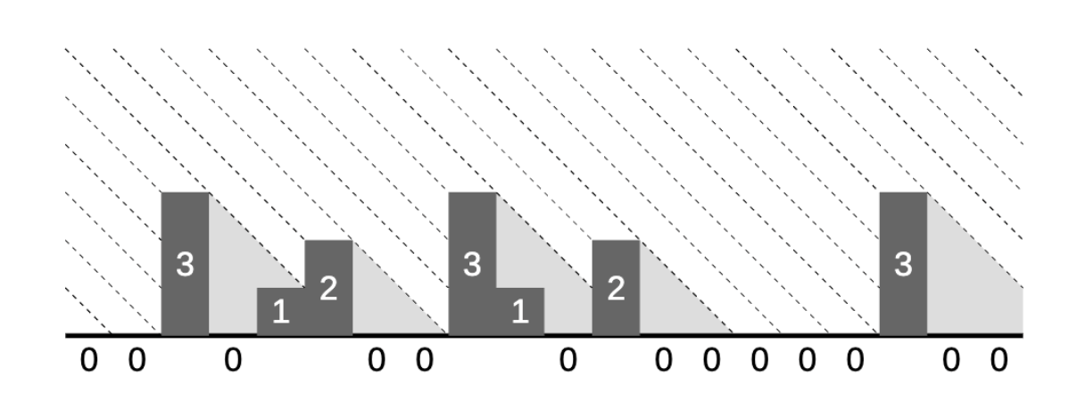
A pedestrain must navigate from (0,0) to (N-1, M-1) while:
- Avoiding buildings (marked 1-9 by height)
- Minimizing exposure to rain falling at a 45° angle
- Accounting for building "rain shadows" that cover
ccells to the right
Input & Output Format
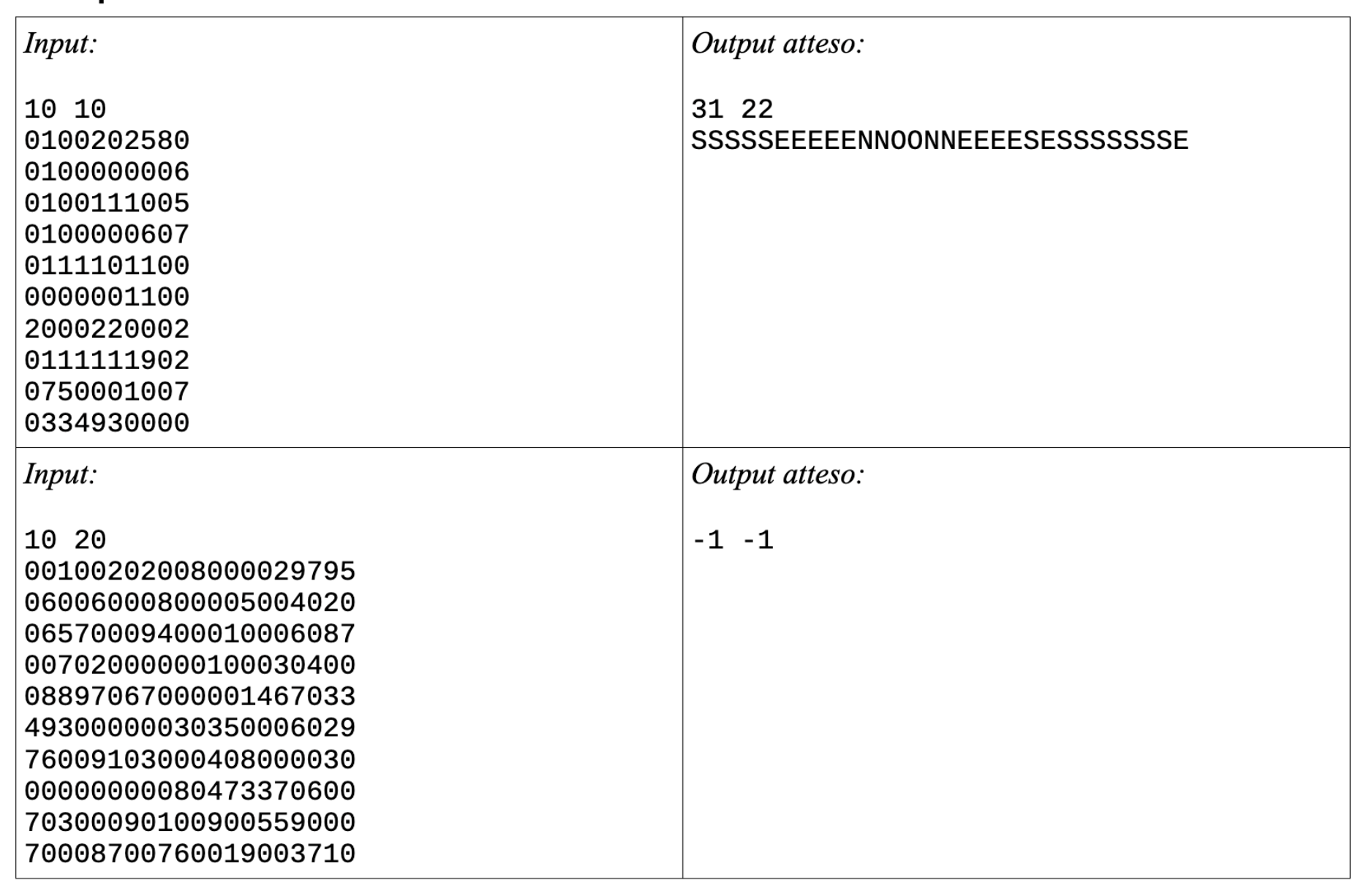
Input
- Grid size:
10 ≤ N, M ≤ 500 - Cell values:
'0'(sidewalk) to'9'(building height)
Output
- Minimum steps
dand rain exposurer - Path sequence (E, O, S, N)
- Returns
-1 -1if unreachable
Implementation Details
The solution requires efficient state management to track position and rain exposure simultaneously.
Keywords
- Dijkstra's Algorithm / BFS
- Dynamic Programming
- Shadow propagation logic
- Memory-efficient grid traversal
Technologies Used
Language: Pure C.
Focus: Algorithm optimization, memory management, graph traversal.
Link repo: GitHub