HEARD Project – Thesis Presentation
Design and Development of Embedded Devices for Hiker Group Safety
Project Description
The HEARD system (Hiking Emergency Assistance and Rescue Device) is an IoT-based solution designed to improve the safety of hiking groups in remote areas, where traditional connectivity is limited or unavailable. The project focuses on real-time group coordination, autonomous monitoring, and proactive detection of dangerous situations.
Objectives
- Enable long-range communication without cellular networks
- Support real-time position sharing among group members
- Detect off-route deviations automatically
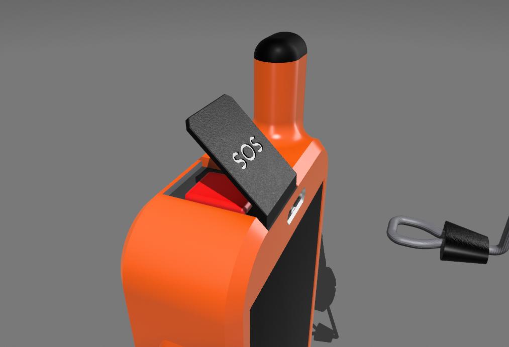
- Provide emergency triggering and fast alert propagation
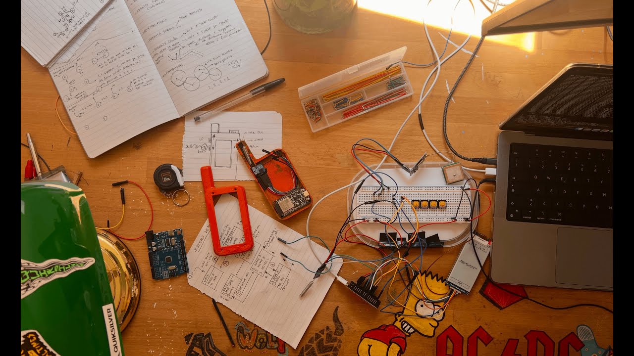
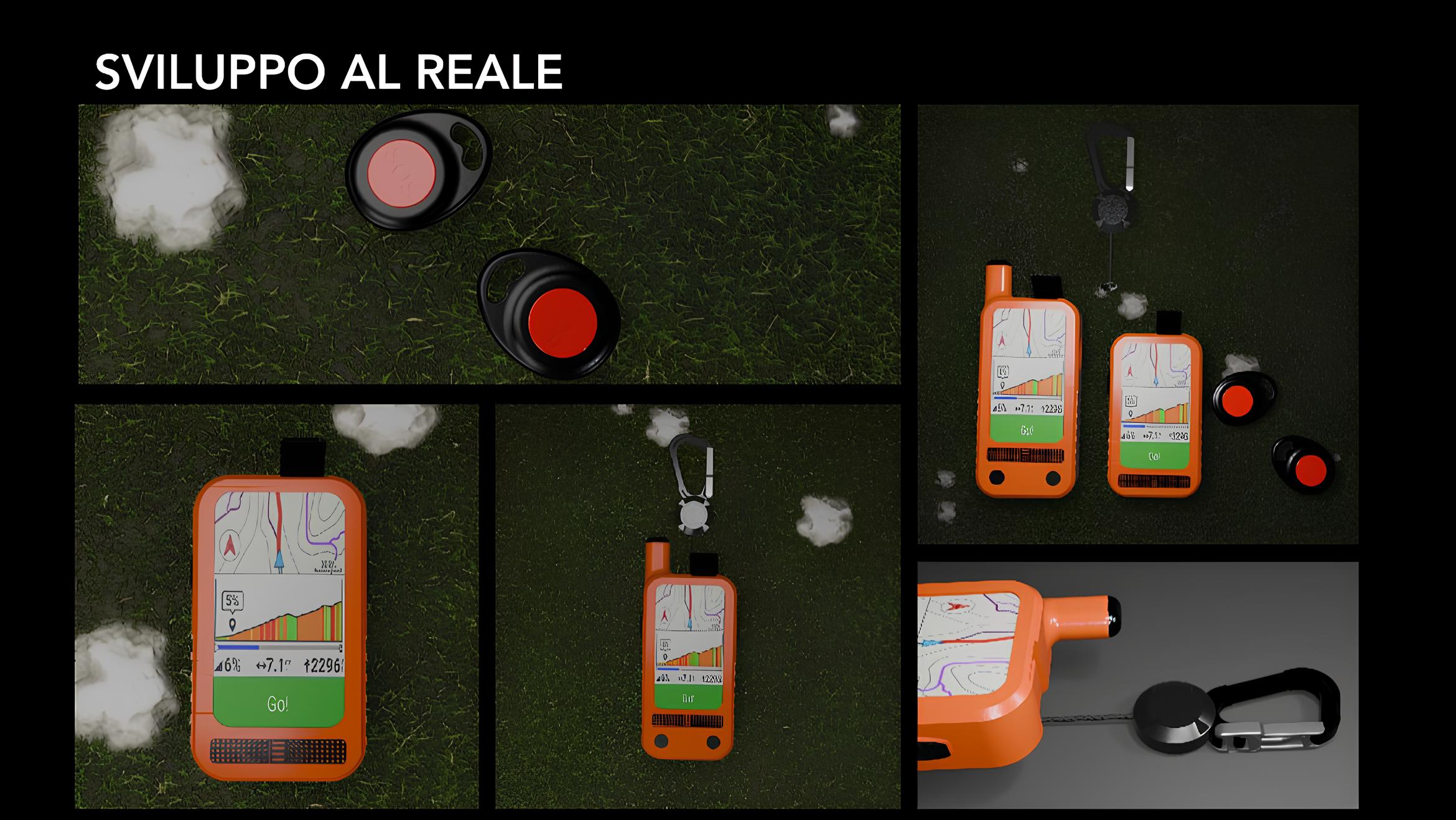
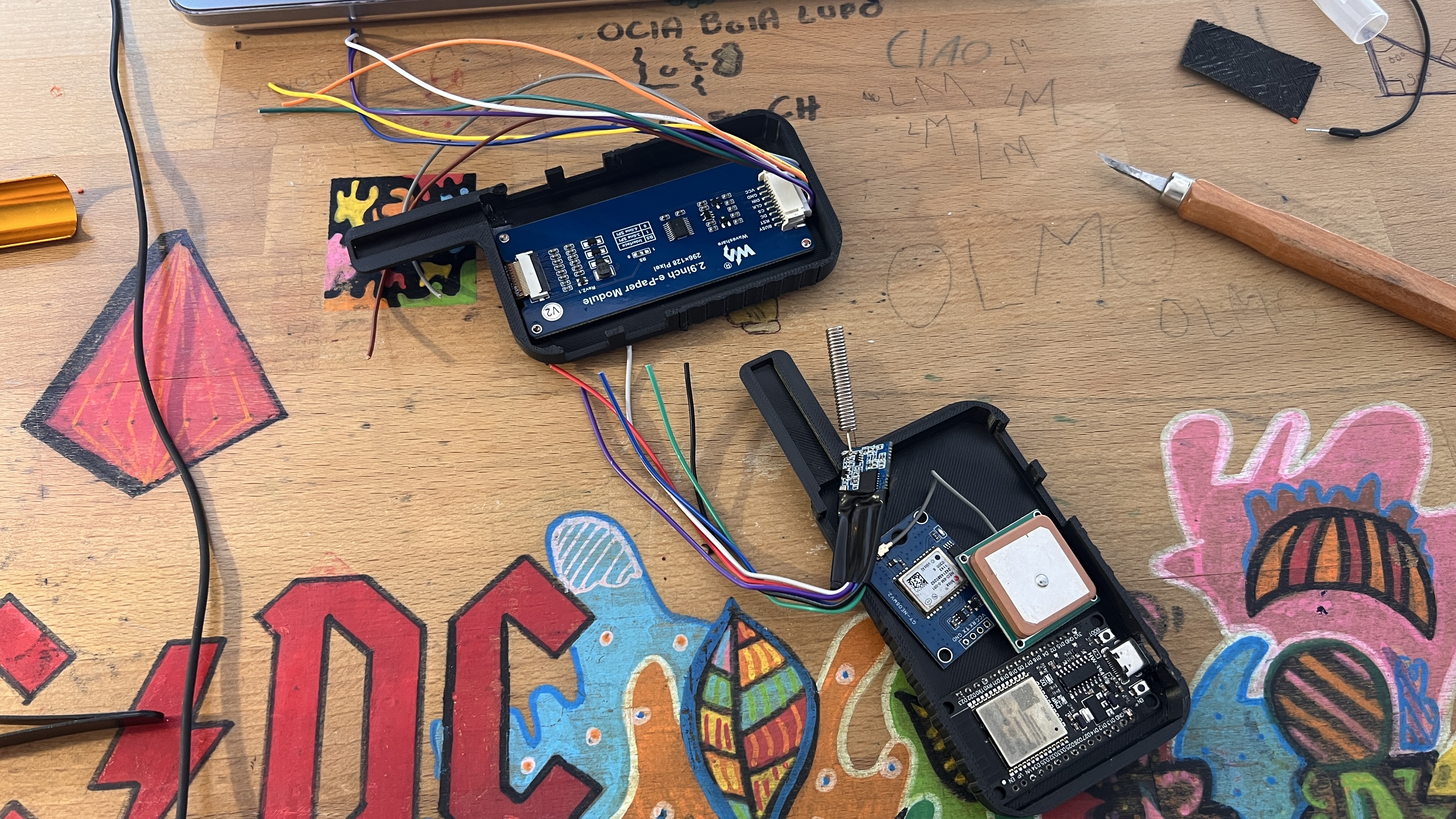
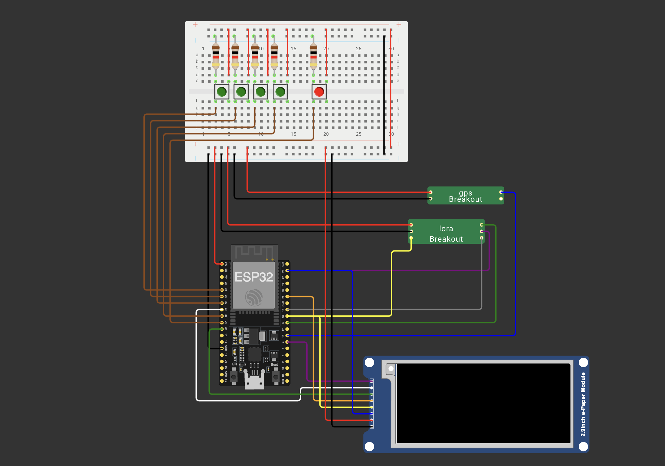
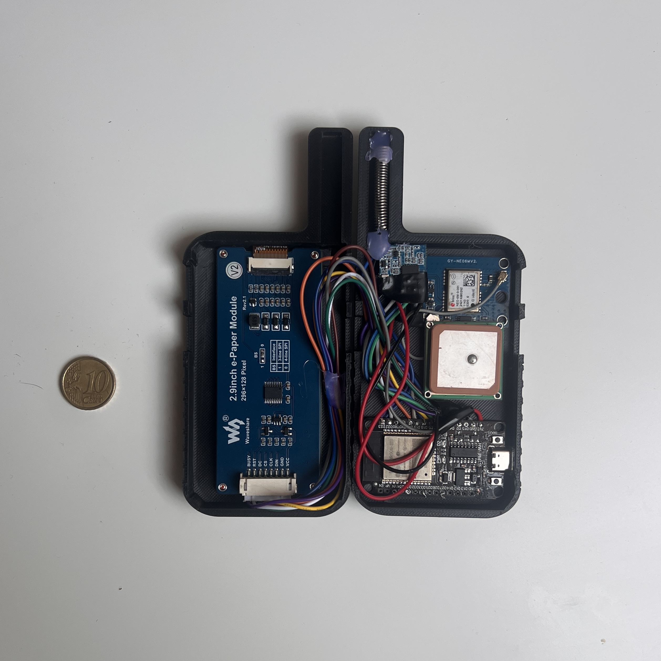
System Architecture
The device ecosystem is composed of three embedded units:
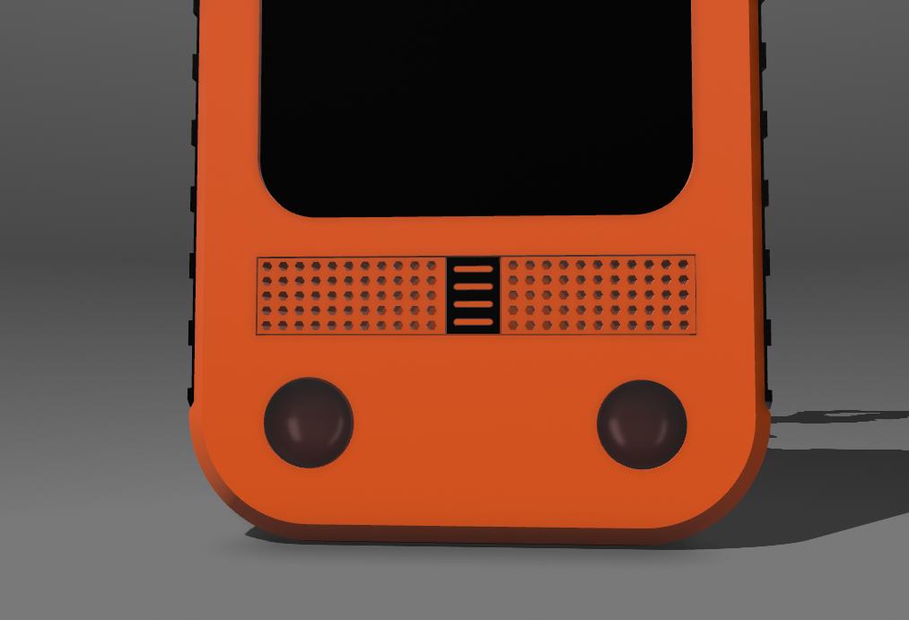
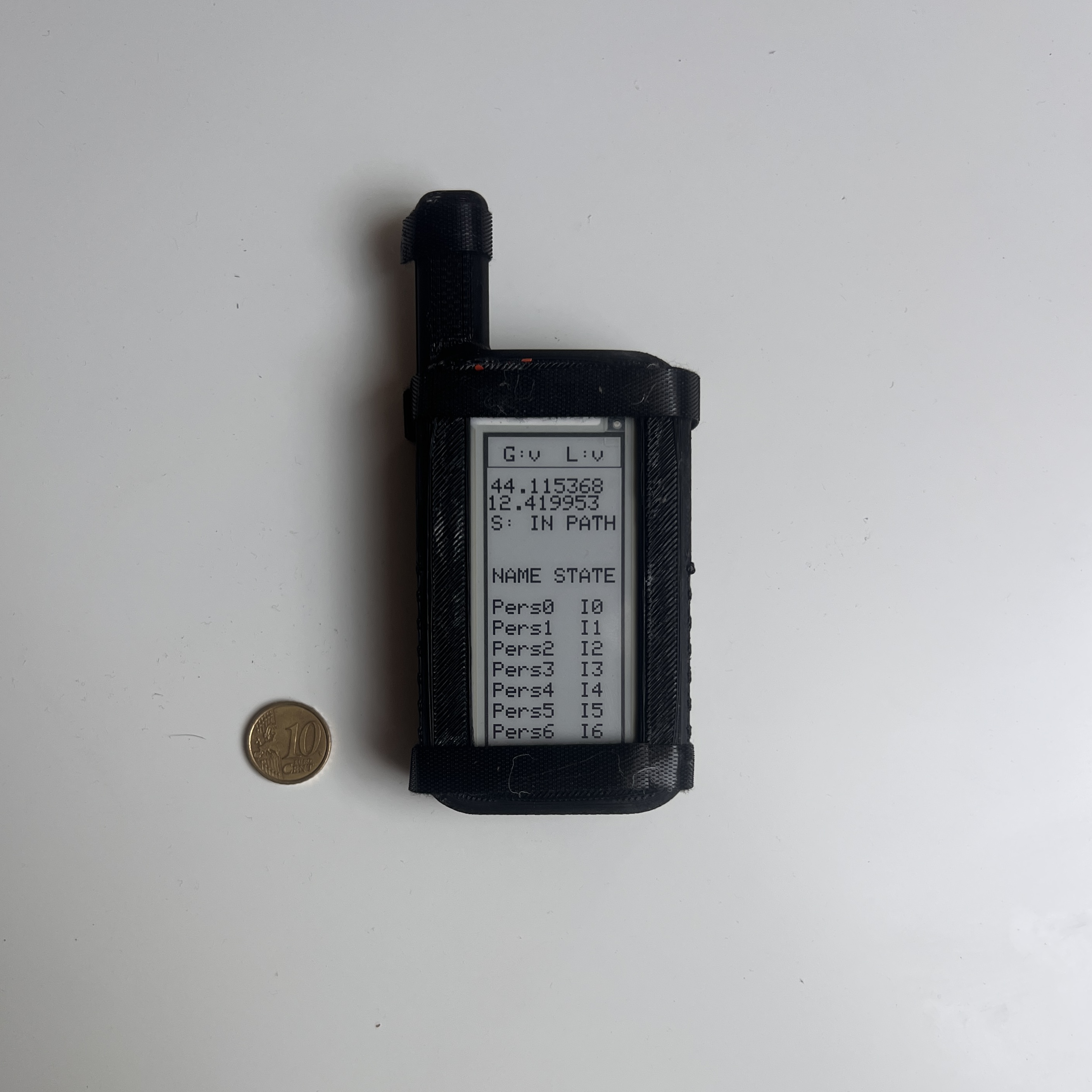
- Heard Core: the group leader’s device, responsible for route creation, synchronization, and global monitoring.
- Heard Node: a compact device for adults, capable of transmitting positions and receiving alerts.
- Heard Pico: a minimal emergency-only device, ideal for children.
Communication Layer
The devices communicate via LoRa, enabling effective long-distance messaging (up to several kilometers). A hybrid communication model allows both direct broadcasting and multi-hop message propagation.
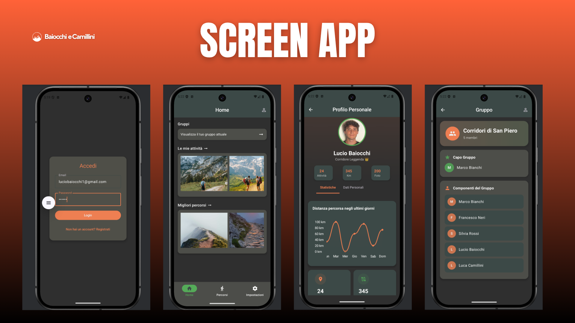
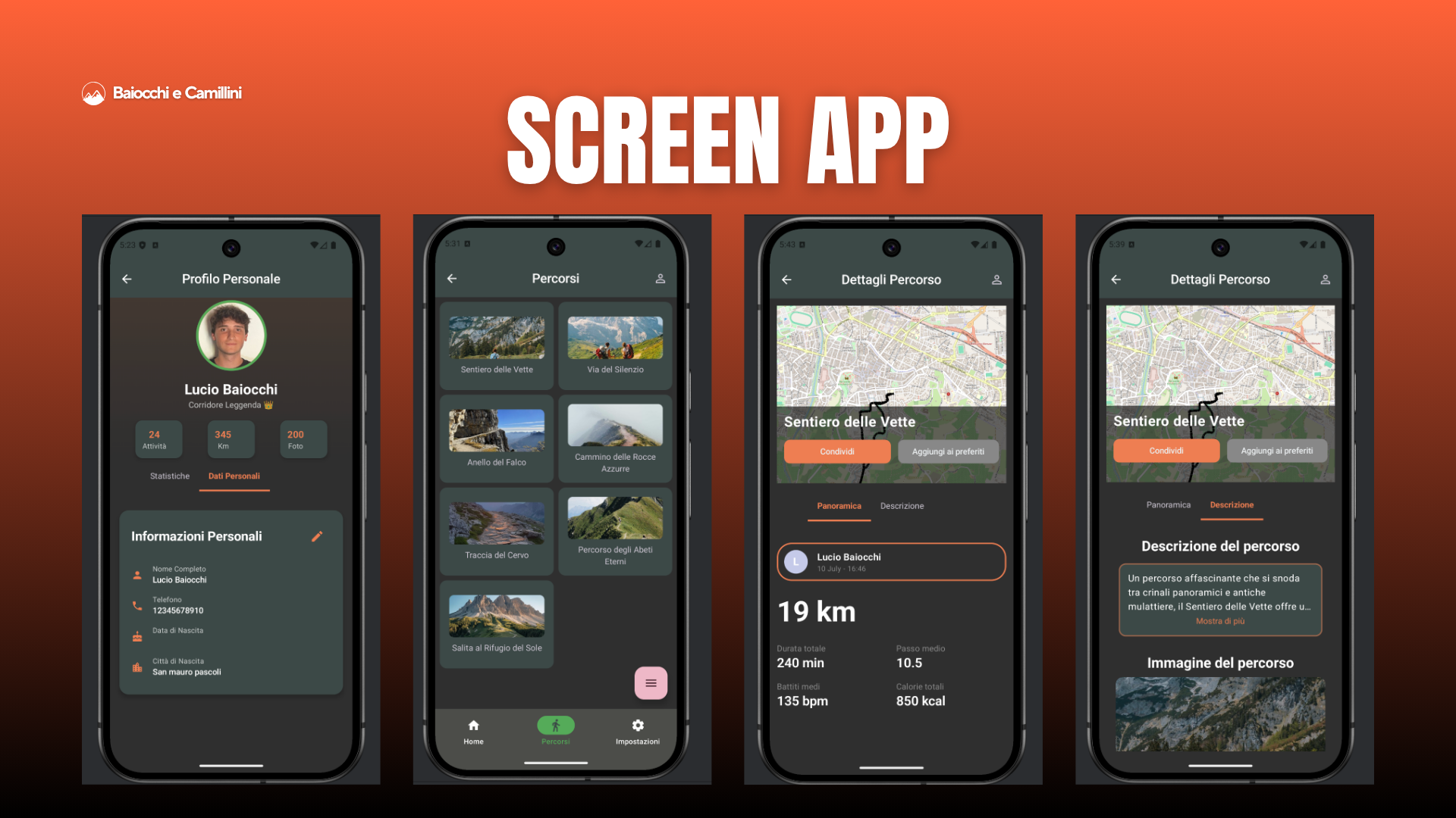
Mobile Application
As an extension of the HEARD system, the mobile application provides a modern interface for viewing group activity, managing routes, and monitoring safety events in real time.
Main Features
- Display of group members’ positions on local offline maps
- Visualization of route progress and safety alerts
- Integration with embedded devices for real-time updates